
UAS ASSISTANT · Web / iPad / iPhone
In development
Your operations, in a single space.
UAS Assistant grew out of the operational experience I gained at TopView. It is an application in development for the web, iPad and iPhone, made for the operator and the team. A shared database brings together mission organisation, guided document work by several people at once, signed PDF generation, fleet management, logbooks updated automatically from operations, and operational support tools for weather, airspace and situational awareness.
- Status
- In development
- Platforms
- Web / iPad / iPhone
01 / UAS Assistant
UAS Assistant / 01—04
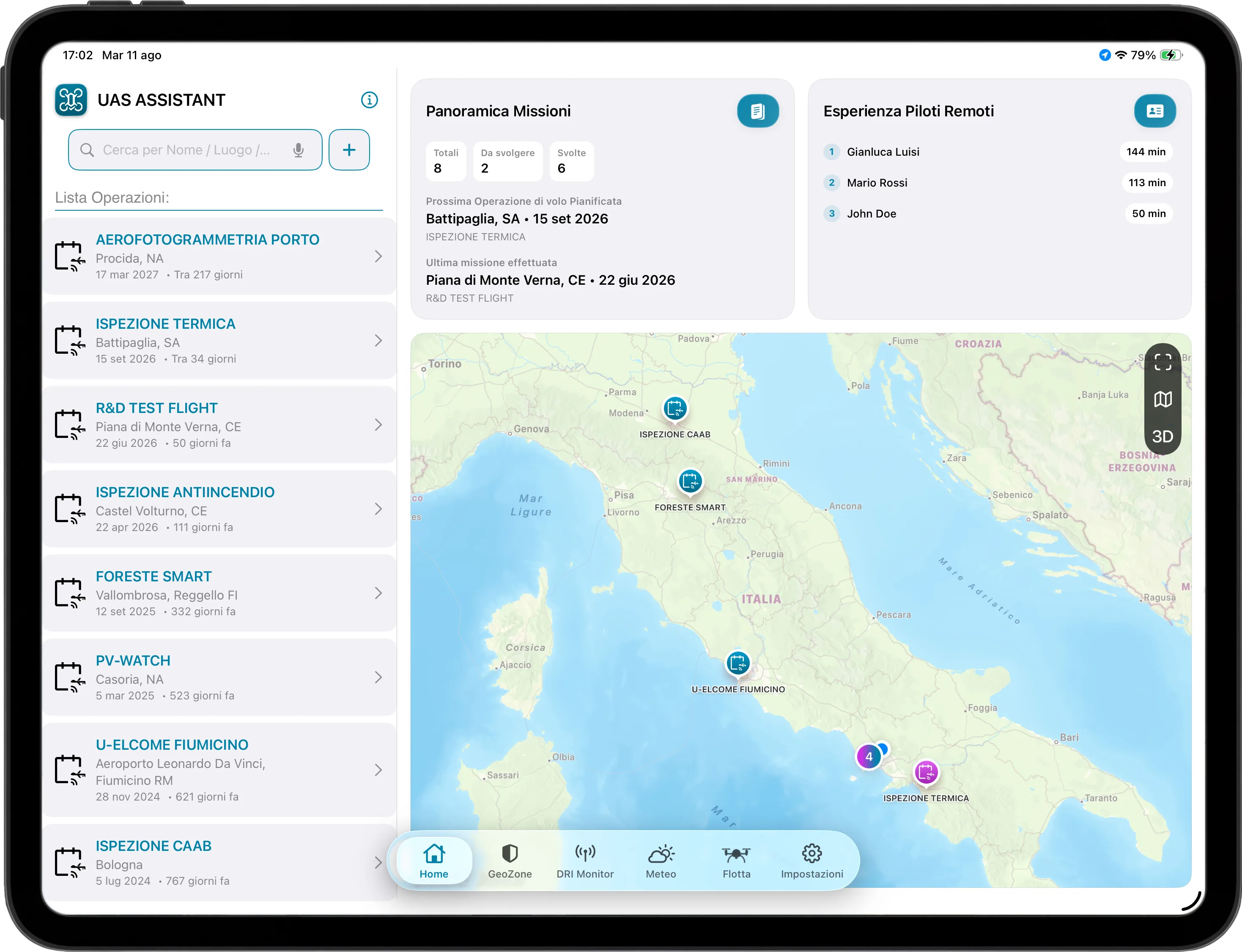
From mission planning to final documentation: one space for the operator and the team, with operations, documents, aircraft and records in the same shared database.
- 01
Missions and an operational Home screen.
The Home screen brings together past and planned operations, provides quick access to the next mission and the latest completed one, summarises recorded remote-pilot flight time and locates activities on the map. The list is shared with the team, so everyone starts from the same operational picture.
- 02
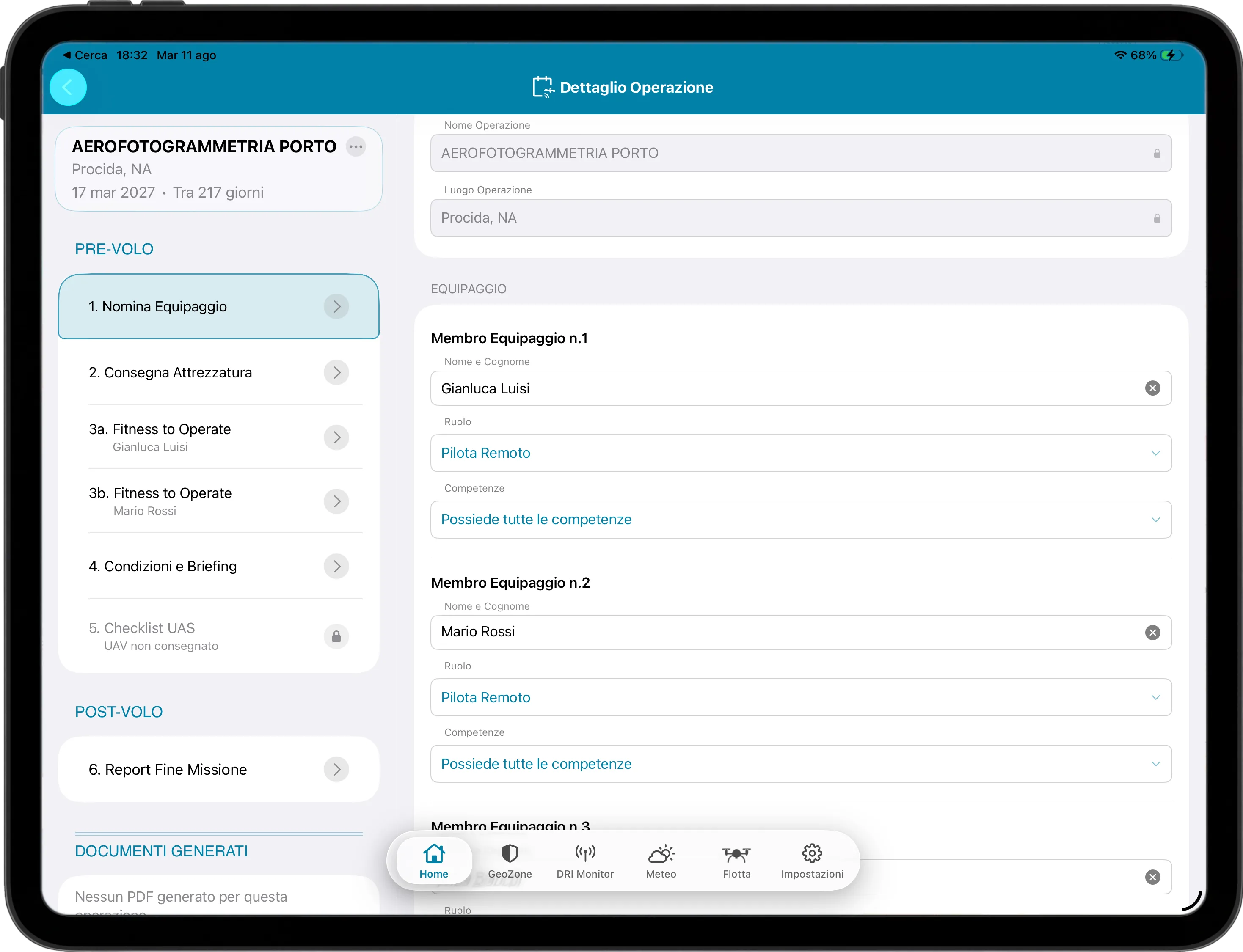
Guided documents, also as a team.
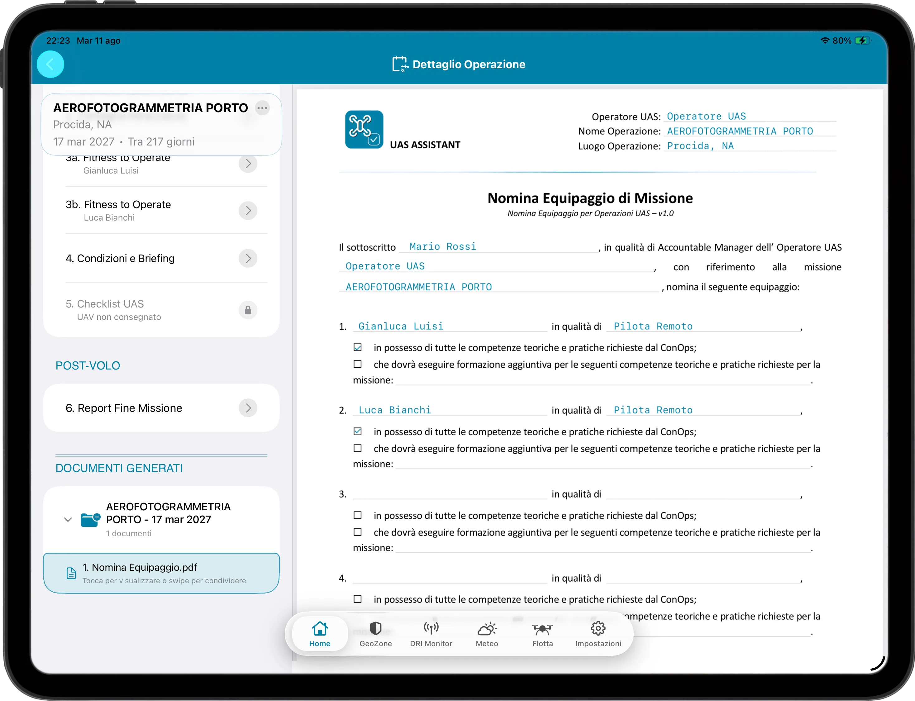
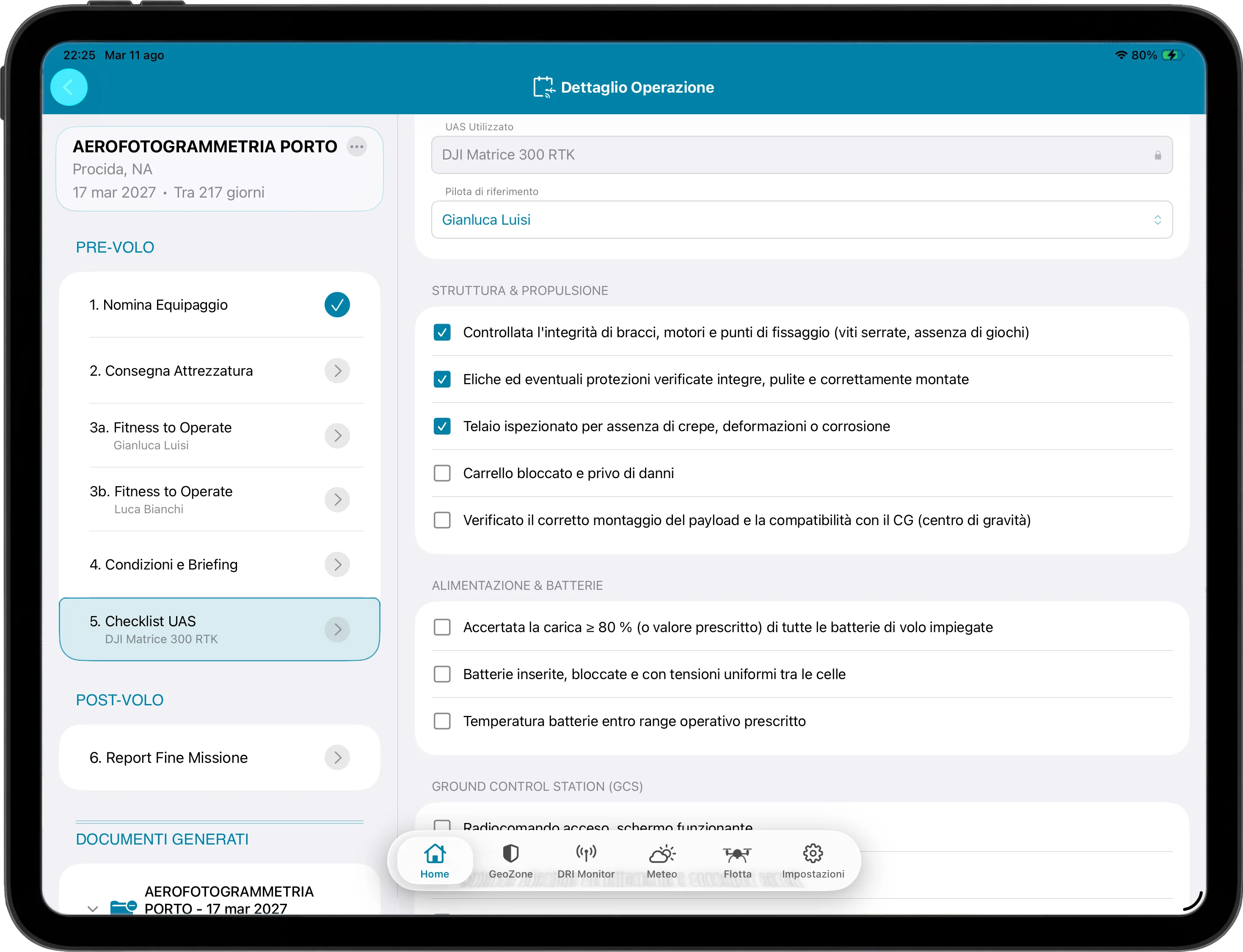
Six structured forms simplify the completion of operational documents and generate PDFs linked to each mission. The shared database lets several people work on the same document workflow at the same time, from the web, iPad or iPhone.
- 03
Fleet and an integrated database.
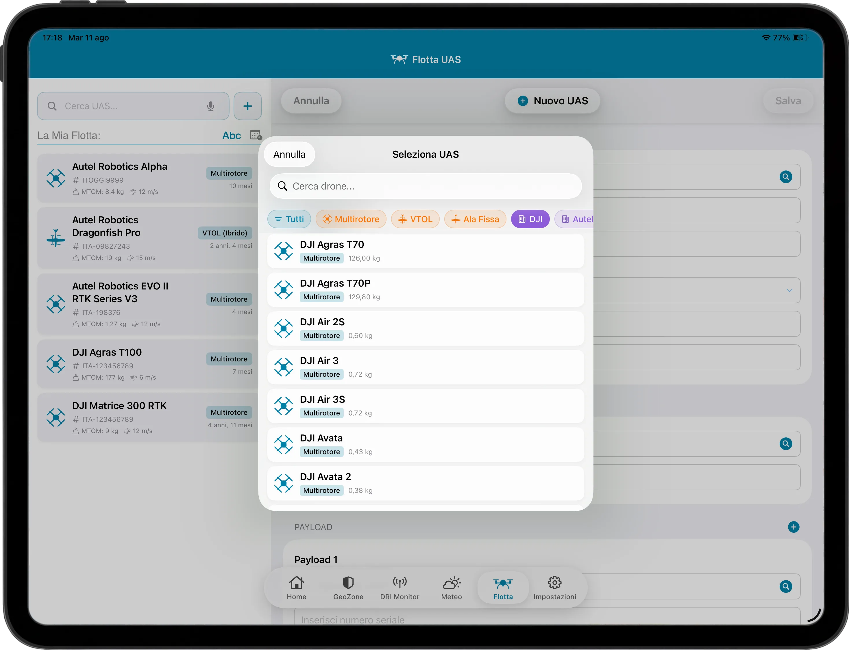
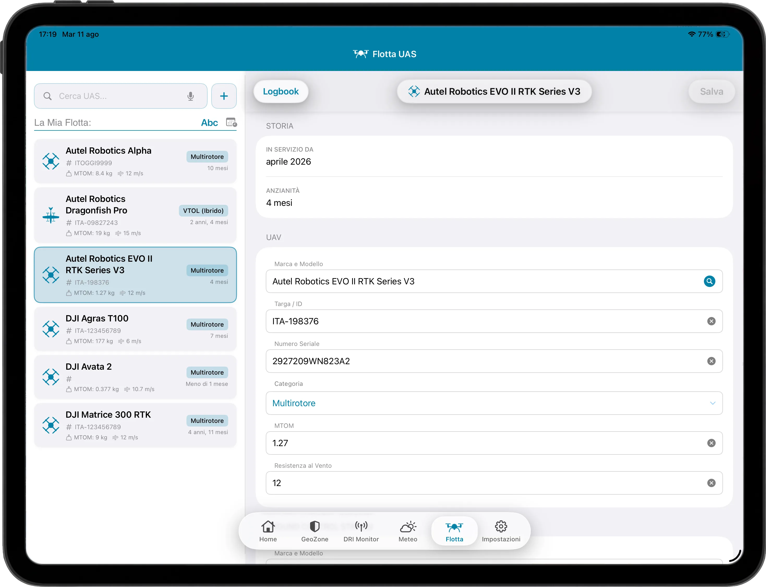
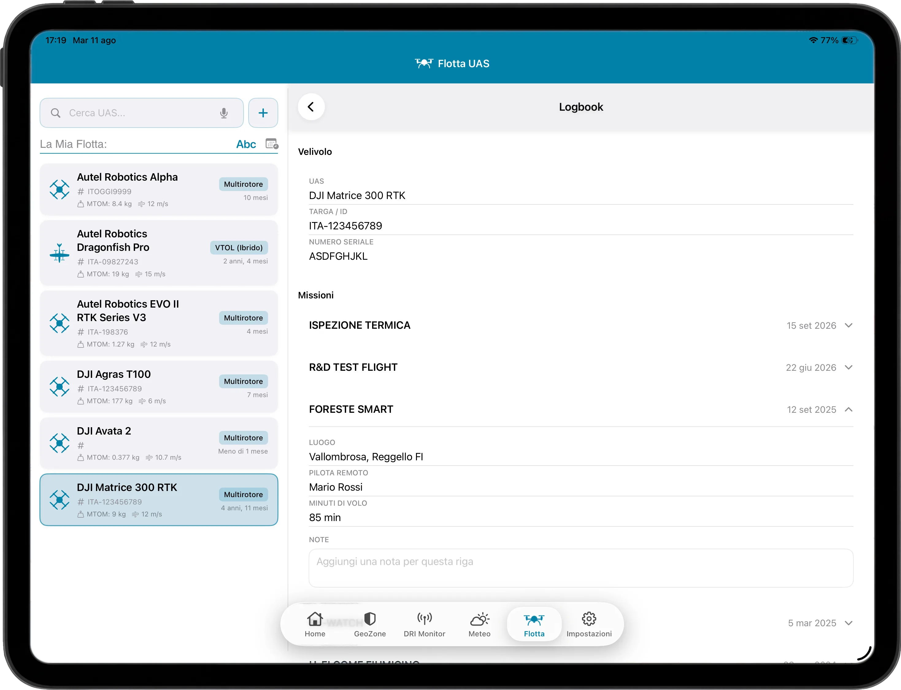
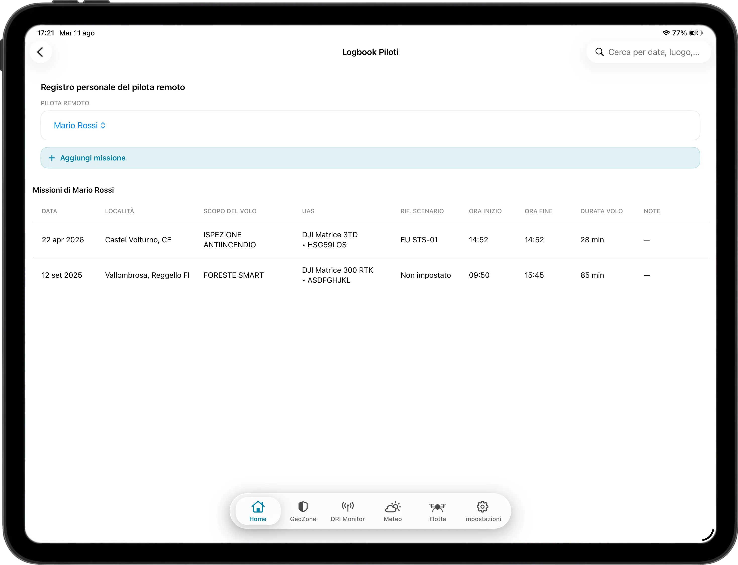
Fleet management records each aircraft’s service age, identifiers, specifications and logbook, visible to the whole operator team. A cross-referenced catalogue links each model to compatible payloads, GCS equipment and accessories, and is designed to be expanded and updated over time.
- 04
Weather, GeoZones and DRI as support.
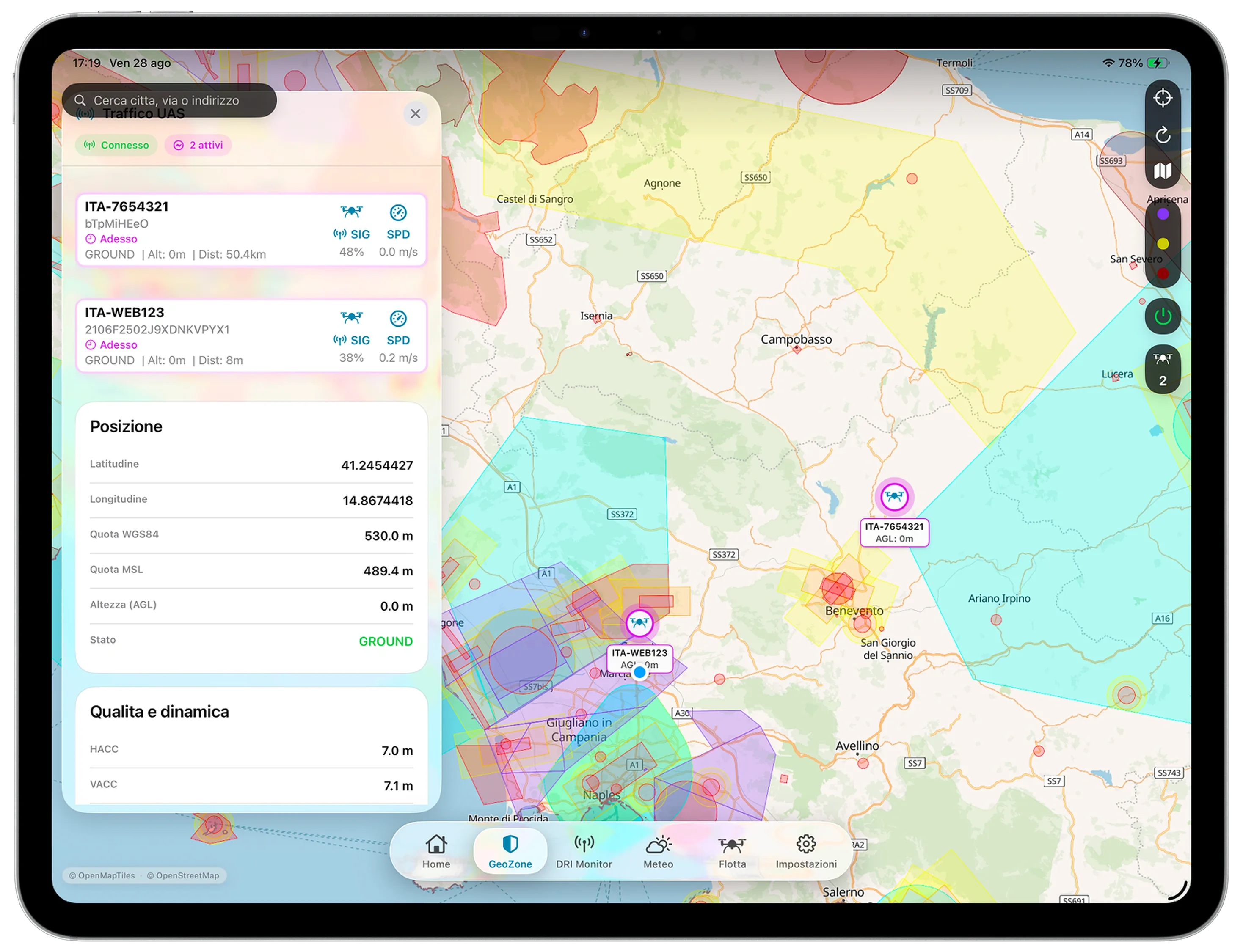
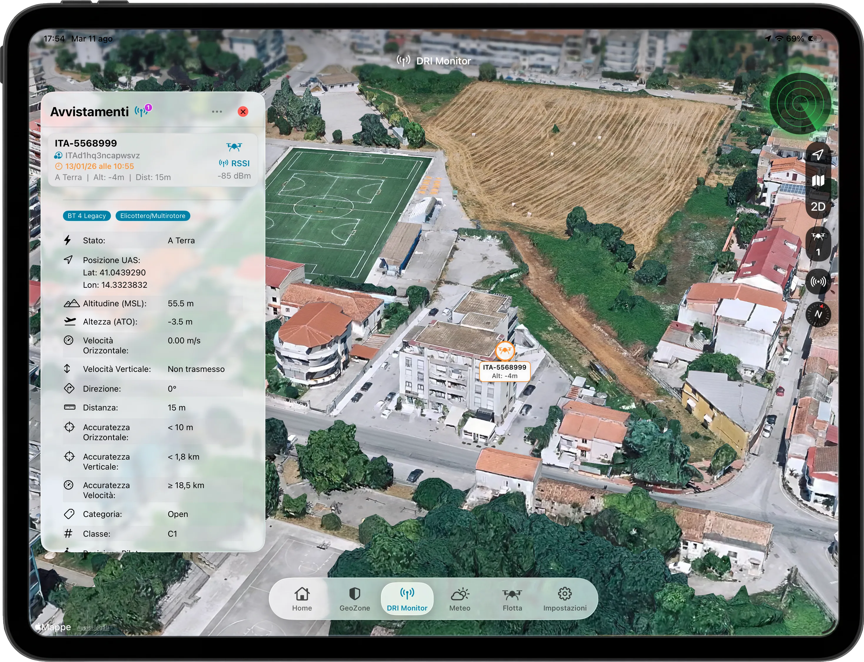
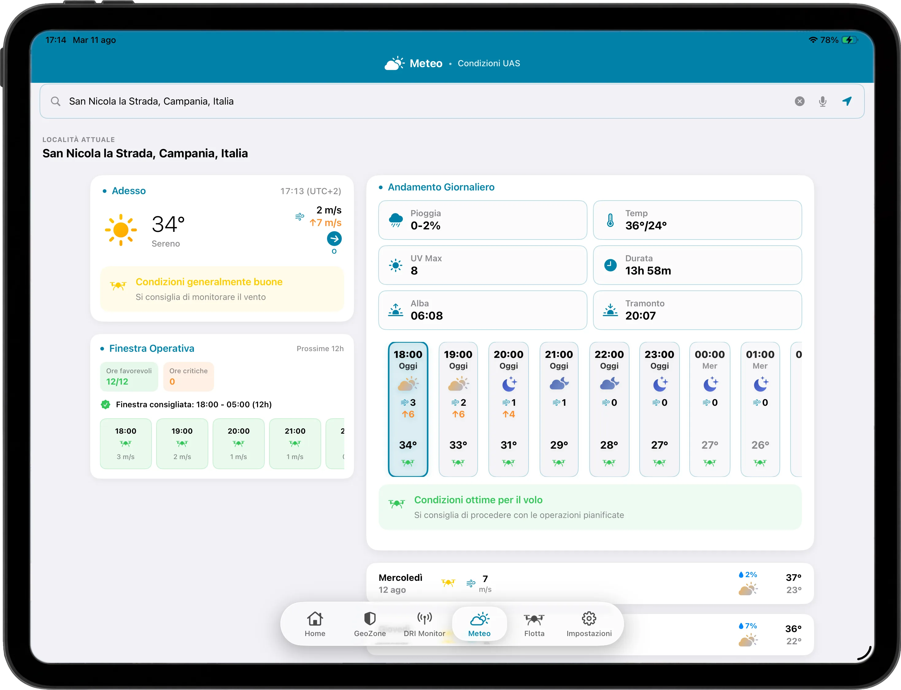
Weather combines wind, rain, visibility and other factors to suggest indicative operating windows, and can include nearby METAR and TAF airport bulletins as additional supporting references; GeoZones provide context for a selected point and can show drones tracked through Pollicino devices; DRI Monitor uses Bluetooth Low Energy to receive Direct Remote Identification messages broadcast by compatible UAS nearby.
The document path
From mission to PDF.
- 01Operation
- 02Guided completion
- 03Signatures and PDFs
- 04Operational archive
Inside the app
Real screens, area by area.
The images show the current iPad application: Home, document forms and PDFs, fleet management, logbooks, weather, GeoZones and DRI Monitor.
02 / UAS Assistant
03 / UAS Assistant
04 / UAS Assistant
05 / UAS Assistant
06 / UAS Assistant
07 / UAS Assistant
08 / UAS Assistant
09 / UAS Assistant
10 / UAS Assistant
11 / UAS Assistant
12 / UAS Assistant
Operational use
A supporting tool, not a replacement.
Weather, GeoZone and DRI features provide supporting information. They do not replace current official sources, risk assessment, applicable regulations or the operator’s decision. Failure to detect a DRI signal does not demonstrate that no UAS are nearby.
Back to Software